How to read a planning certificate?
A planning certificate is intended to inform a purchaser about town planning rules and restrictions that apply to a property. In practice, it doesn’t achieve this. This is because:
- The actual rules that apply aren’t included in the certificate just the name of applicable controls, which for most users won’t mean much (or in some cases, are even misleading).
- You need a bit of background knowledge to understand the terminology in the certificate.
- Most purchasers are interested in the rules that apply to neighbouring land as well as the land they are buying and a planning certificate doesn’t tell you anything about the rules that apply to neighbouring land.
That said, the certificate is a useful prompter for what you should be considering from a town planning perspective when buying a property, namely:
- Can I use the land for my intended purpose?
- Can I add the improvements I have in mind?
- What are my neighbours allowed to do with their land? Could apartments be built next door? Could a take away food shop replace the current architect’s office next door?
What is included in a certificate?
A section 32 statement must disclose matters relating to the permissible use and development of the purchase property, specifically:
“(d) in the case of land to which a planning scheme applies a statement specifying—
(i) the name of the planning scheme;
(ii) the name of the responsible authority;
(iii) the zoning of the land;
(iv) the name of any planning overlay affecting the land.”
What is a ‘planning scheme’, ‘responsible authority’, ‘zone’ and ‘overlay’?
Every local Council area has a planning scheme which lays down the rules for land use and development. All land in Victoria is subject to a planning scheme except for land owned by the Commonwealth Government.
Planning schemes consist of standard parts. ‘Zones’ and ‘overlays’ are particularly important parts of a planning scheme in determining what is and isn’t allowed. Broadly, a zone says how you can ‘use’ land, e.g. you can ‘use’ land in a residential zone for a residence without needing a permit, but you would need a planning permit to use this residential zoned land for a shop. The aim of zoning is to separate incompatible uses, like industry from houses.
‘Overlays’ deal with building and constructions matters, like building height, flooding, heritage restrictions and / or specific environmental issues like vegetation protection or erosion management. Whilst all land is ‘zoned’, only some land has an overlay applied.
The ‘responsible authority’ is usually your local council (on rare occasions, it is the Minister of Planning or some other government authority). The responsible authority is responsible for deciding planning permit applications and enforcing the planning scheme.
Reading your planning certificate and getting the information you need
Your planning certificate will tell you the name of planning scheme, zone and applicable overlays, but that doesn’t tell you much. You need to go to planning scheme and read the actual zone and overlay provision (i.e. the relevant ‘rules’) to see what is or isn’t allowed.
In addition, it’s often just as important to know the zones and overlays that apply to neighbouring land, e.g. to see what would be allowed to be built next door in future.
By far and away, the best way to consider the planning rules when purchasing a property is to generate your own ‘planning property report’ from the Government’s land.vic.gov.au website. This service is free and reliable. Here’s what you do: [series of screen shots, e.g. as below]
- Go to land.vic.gov.au
- Click on ‘planning maps online’ on the right of the page
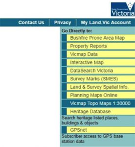
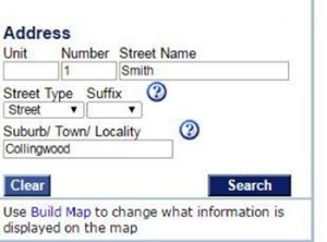
- Type in the address on the left side of the page and hit search
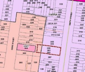
- The property will be selected on the map in red hatching
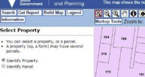
- With the property selected, click ‘get report’ in the upper right of the page
- By following the prompts, you will generate a ‘planning property report’ (like the following) which shows the zones and overlays that apply to the purchase land and neighbouring land. The planning property report includes hyperlinks in blue which will take you directly to the rules that apply in the relevant zone or overlay.
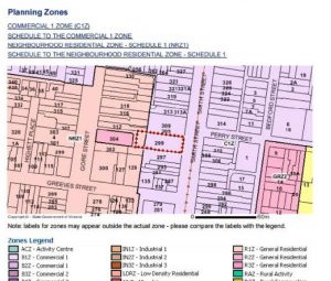
The above is a simple and basic guide on how to find out the zone or overlays affecting a property. Please contact us if you require further assistance.
Sean McArdle
Solicitor
Read more on planning certificates https://www.planning.vic.gov.au/